
2D Orthomosaic Mapping Services
Precision Mapping
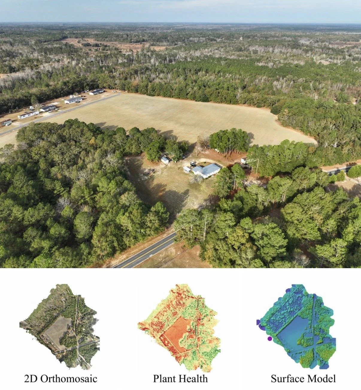
Our 2D orthomosaic mapping delivers high-accuracy, georeferenced imagery built for decision-makers who need reliable data on every acre. Using professional aerial capture workflows, we produce detailed maps that reveal field boundaries, crop conditions, drainage patterns, soil transitions, access paths, and structural features with exceptional clarity.
What We Deliver:
• High-resolution 2D orthomosaics suitable for GIS analysis, crop planning, and land management.
• Accurate field documentation for agriculture, including multi-crop environments like corn, cotton, peanuts, and wheat.
• Mapping support for acreage verification, compliance reporting, irrigation planning, and site evaluation.
• Deliverables formatted for integration into ArcGIS, QGIS, engineering workflows, and planning systems.

Asset Assessment for Telecom
Line of Sight, No Line Workers
We inspect towers, antennas, and broadcast infrastructure with precision—no climbing crews, no delays. Our drones capture every angle to ensure safe operations, compliance, and minimal downtime.
What We Deliver:
High-res close-ups of mounts, cabling, and RF components.
Visual documentation for compliance, maintenance, and asset records.
Scalable service plans for routine inspections or on-call dispatch.
3D mapping of Arrays
2D Orthomosaics of property and assets
Site Orbit video and photos
Asset Assessment for Property Management
Spot Issues Before Tenants Do
We inspect roofs, facades, gutters, and parking structures without disrupting residents or risking worker safety. From apartment complexes to commercial buildings, our drone inspections deliver peace of mind.
What We Deliver:
Aerial imagery of rooftops, HVAC systems, siding, and drainage.
Pre-sale, pre-lease, and post-storm documentation.
Visual reports designed for maintenance planning and insurance filings.